
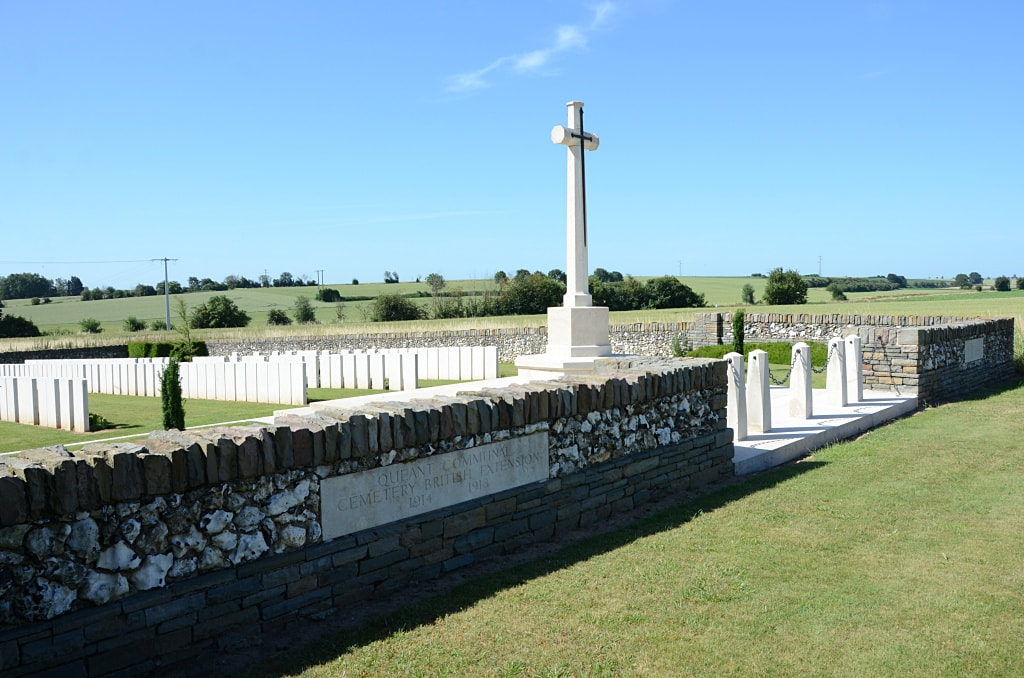
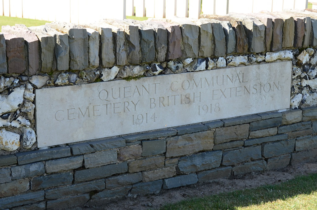
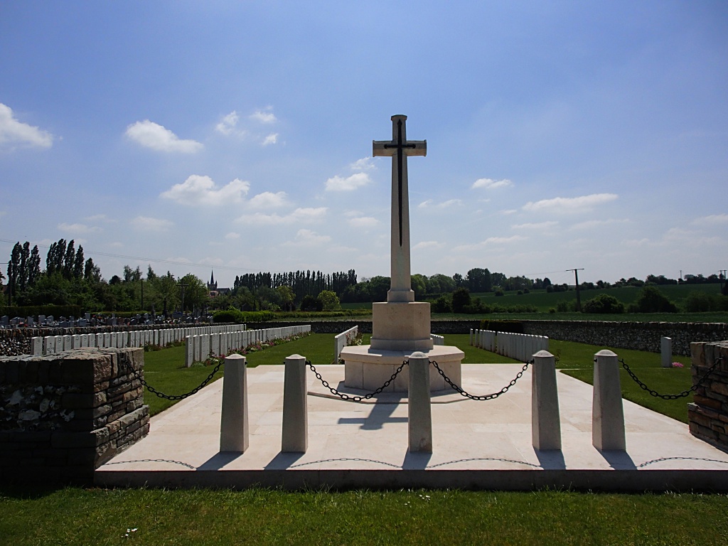
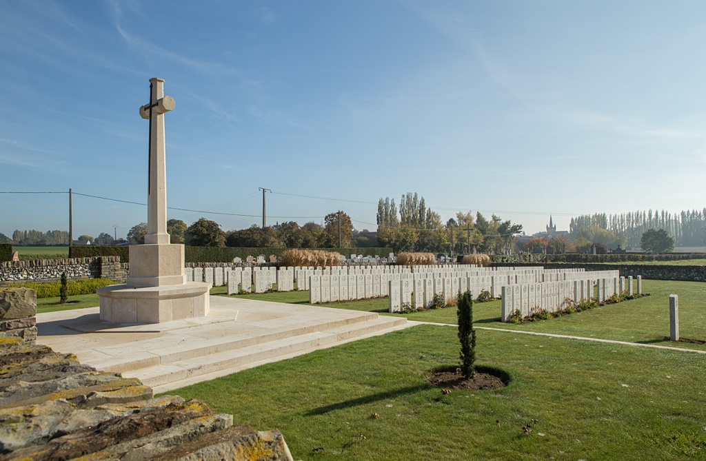
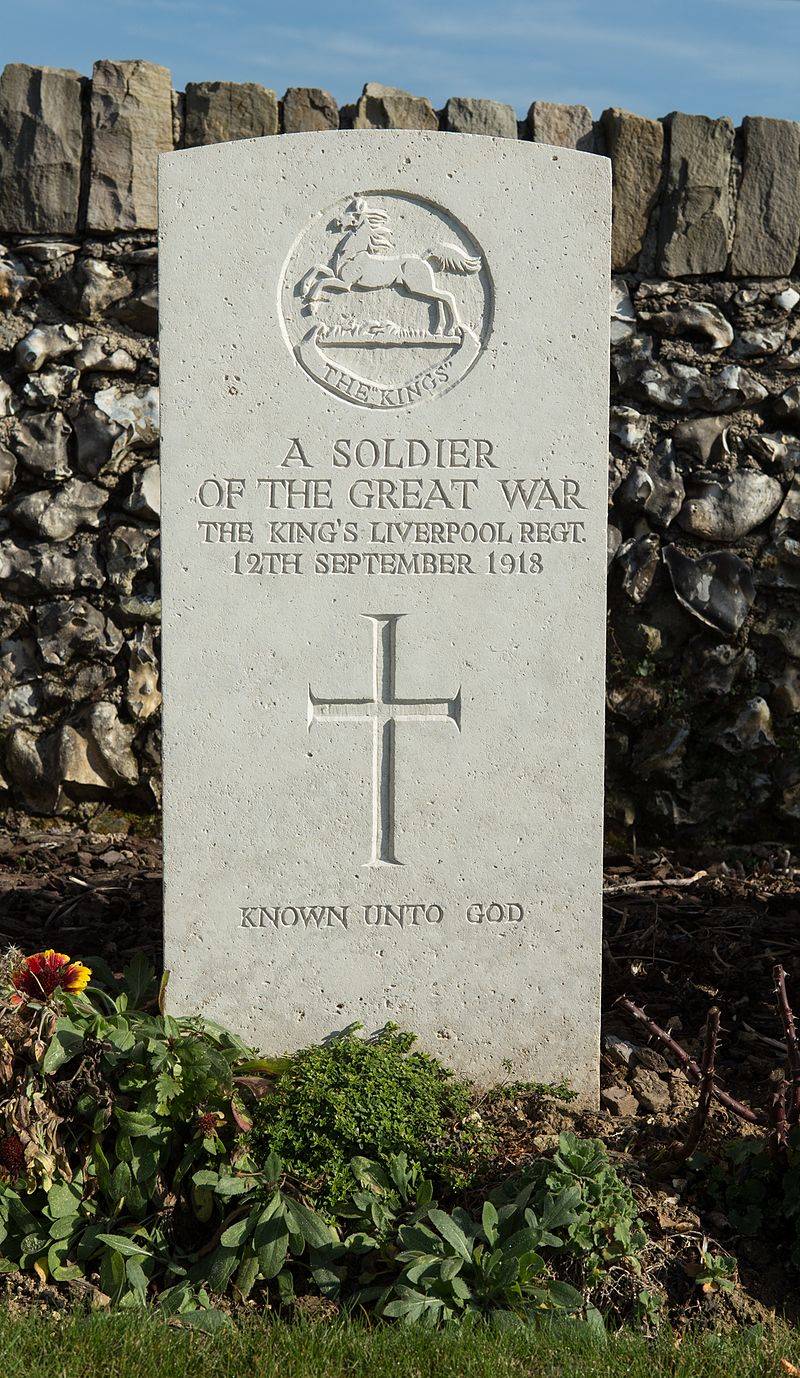
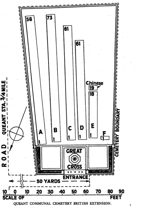
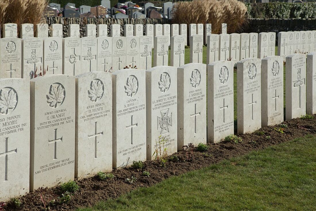
QUÉANT COMMUNAL CEMETERY BRITISH EXTENSION
Pas De Calais
France
Location Information
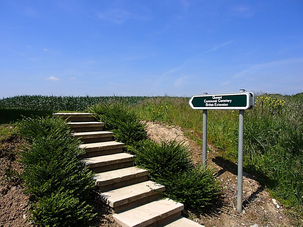
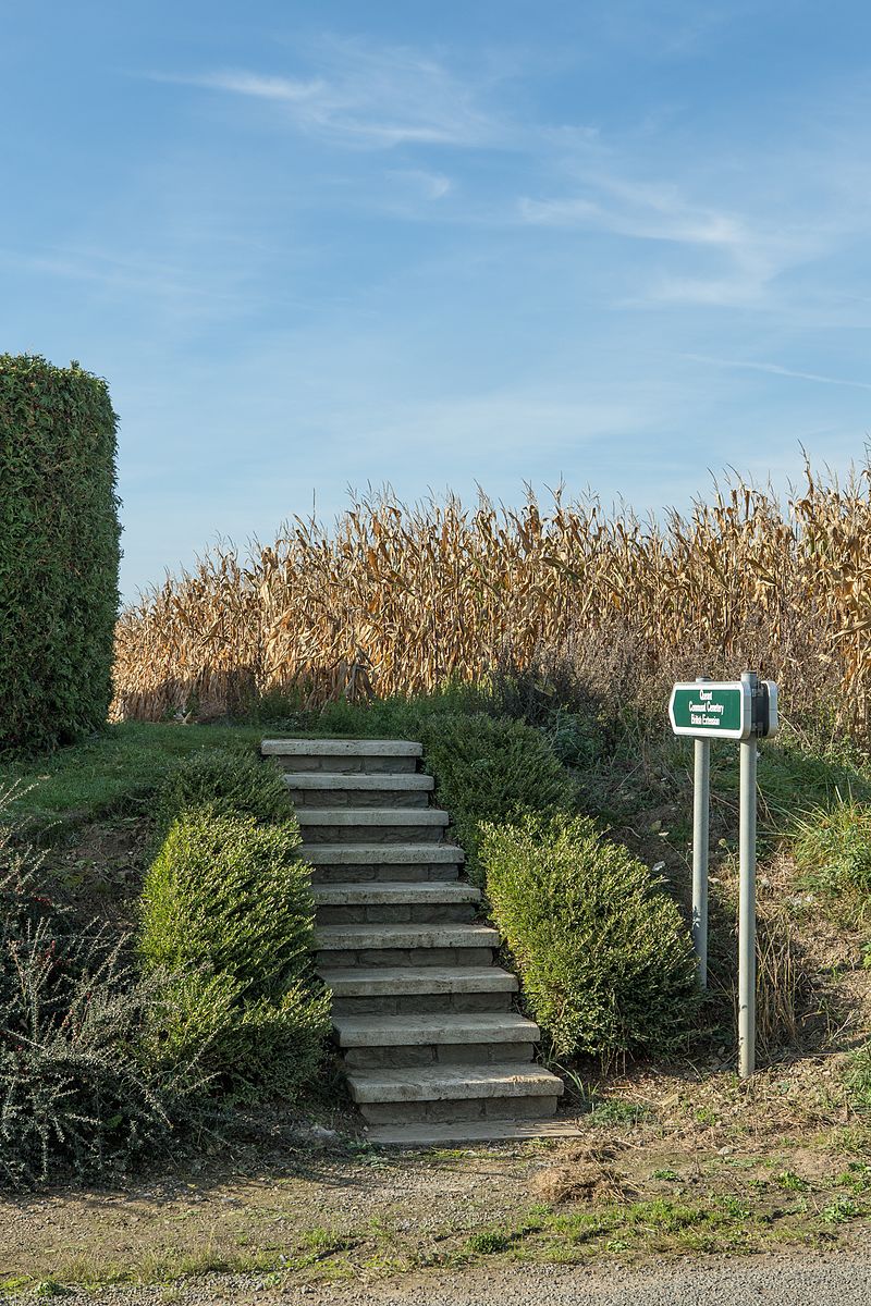
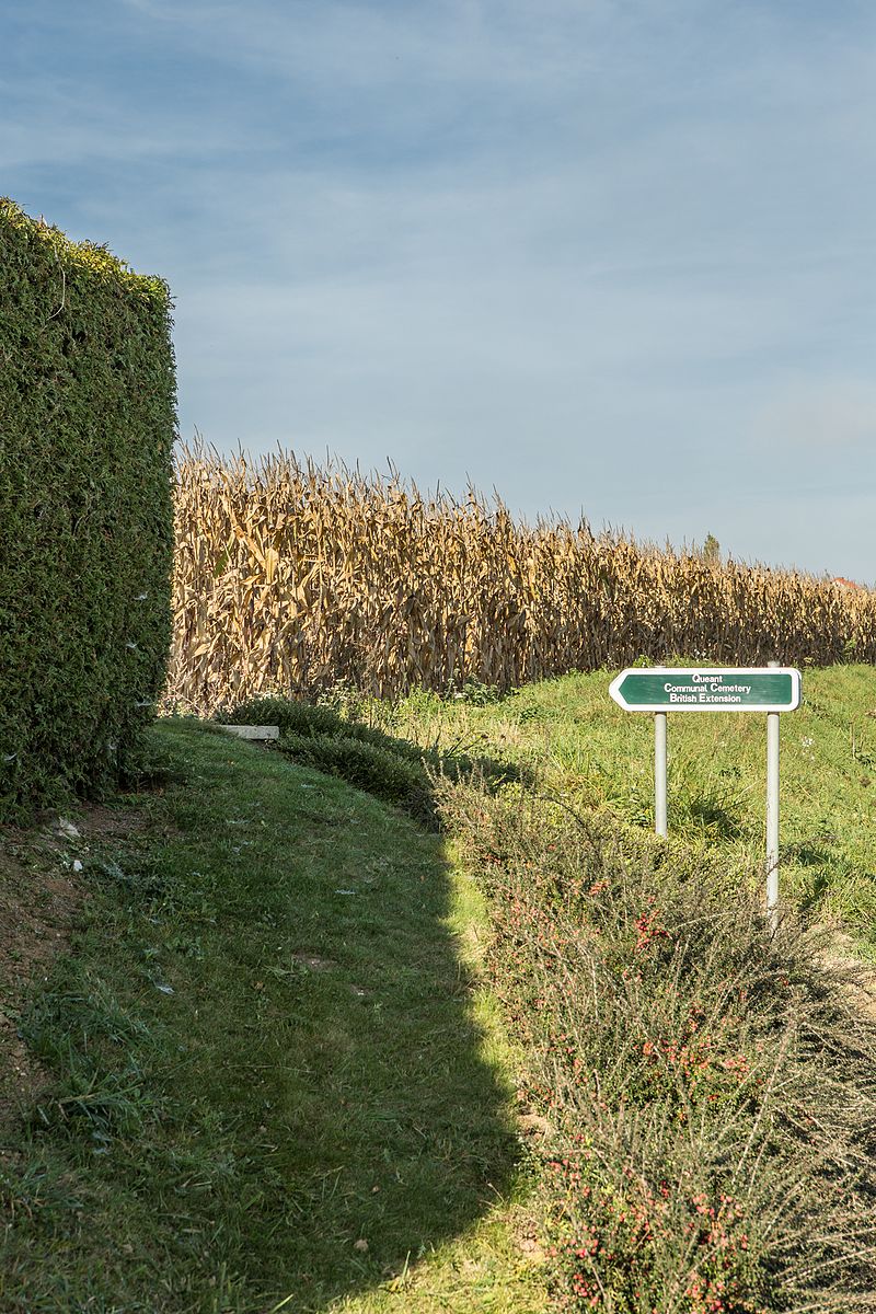
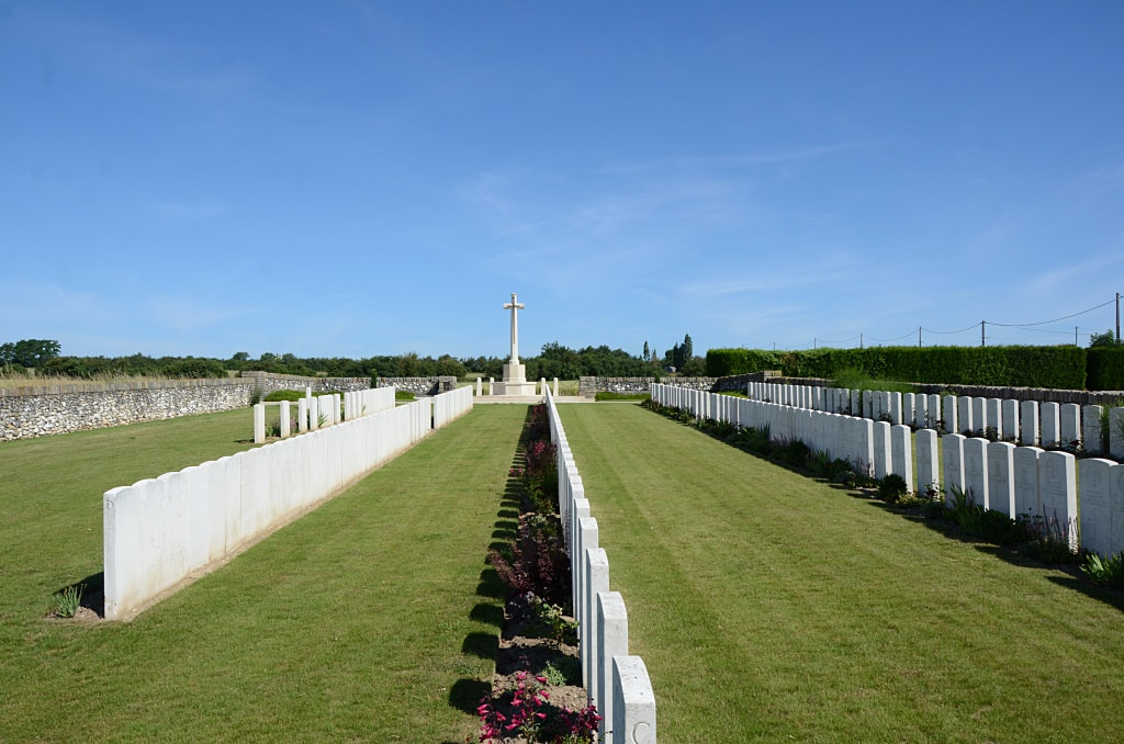
Quéant is a village on the D14 road 25 kilometres south-east of Arras. The Cemetery is on the western outskirts of the village on the D38 road to Riencourt-les-Cagnicourt.
Visiting Information
The location or design of this site makes wheelchair access impossible.
Historical Information
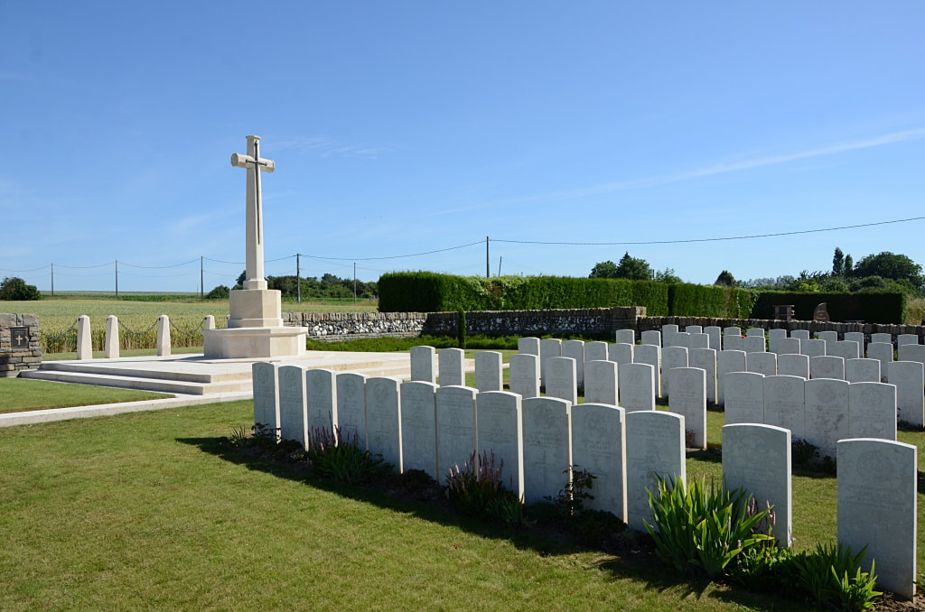
Queant was close behind the Hindenburg Line, at the South end of a minor defence system known as the Drocourt-Queant Line, and it was not captured by British troops until the 2nd September 1918.
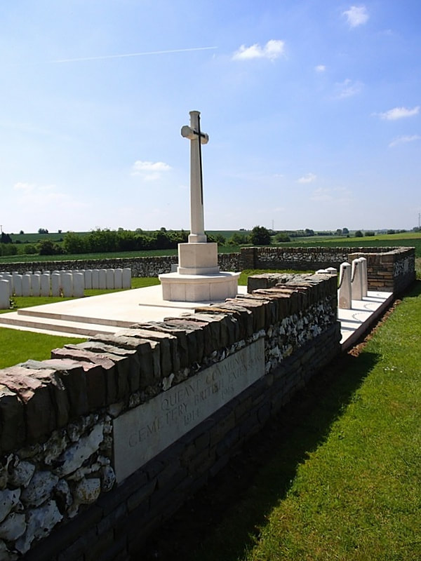
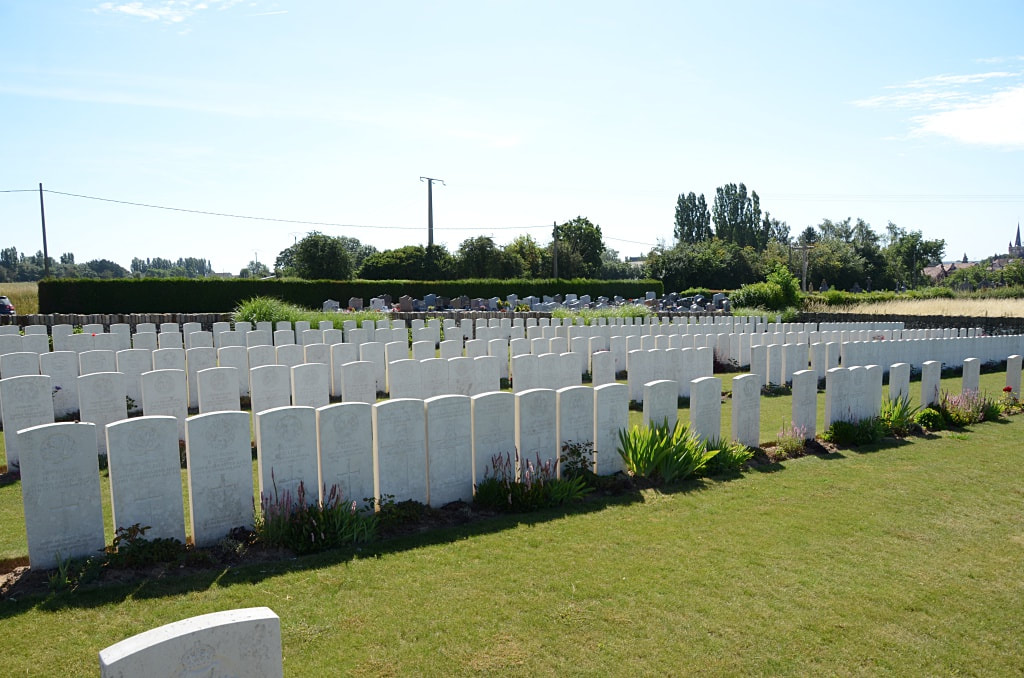
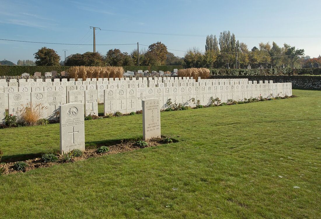
On the North side of the Communal Cemetery was a German Extension of nearly 600 graves (1916-1918), now removed; and the British Extension was made by fighting units, on the far side of the German Extension, in September and October 1918.
There are now nearly 300, 1914-18 war casualties commemorated in this site. Of these, a small number are unidentified.
The cemetery covers an area of 1,011 square metres and is enclosed by a flint and rubble wall.
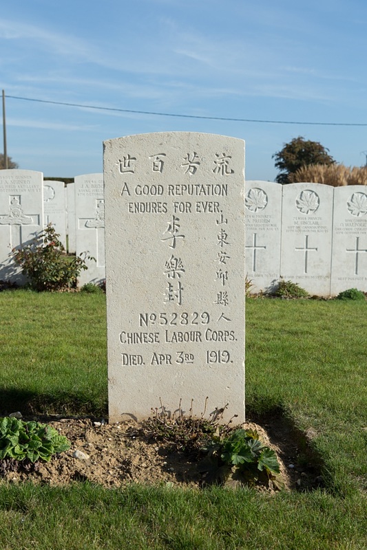
Casualty Details: UK 161, Canada 112, New Zealand 3, Total Burials: 276.
The cemetery was designed by Edwin Lutyens & George Hartley Goldsmith
Quéant is a village on the D14 road 25 kilometres south-east of Arras. The Cemetery is on the western outskirts of the village on the D38 road to Riencourt-les-Cagnicourt.
Visiting Information
The location or design of this site makes wheelchair access impossible.
Historical Information
Queant was close behind the Hindenburg Line, at the South end of a minor defence system known as the Drocourt-Queant Line, and it was not captured by British troops until the 2nd September 1918.
On the North side of the Communal Cemetery was a German Extension of nearly 600 graves (1916-1918), now removed; and the British Extension was made by fighting units, on the far side of the German Extension, in September and October 1918.
There are now nearly 300, 1914-18 war casualties commemorated in this site. Of these, a small number are unidentified.
The cemetery covers an area of 1,011 square metres and is enclosed by a flint and rubble wall.
Casualty Details: UK 161, Canada 112, New Zealand 3, Total Burials: 276.
The cemetery was designed by Edwin Lutyens & George Hartley Goldsmith


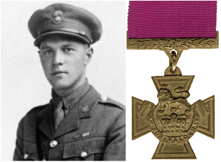
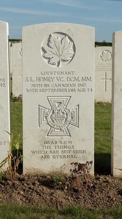
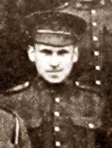
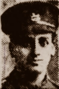
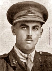
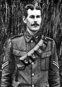
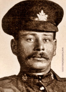
Lieutenant Samuel Lewis Honey, V. C., D. C. M., M. M.,
78th Bn. Canadian Infantry (Manitoba Regiment), died of wounds 30th September 1918 aged 24. Row C. 36.
Son of the Rev. George E. Honey and Metta B. Honey of Lynden, Ontario.
His headstone bears the inscription; "Dear Lew, The Things Which Are Not Seen Are Eternal."
Citation: An extract from the London Gazette, No. 31108, dated 3rd Jan., 1919, records the following: "For most conspicuous bravery during the Bourlon Wood operations, 27th September to 2nd October, 1918. On 27th September, when his company commander and all other officers of his company had become casualties, Lt. Honey took command and skilfully reorganised under very severe fire. He continued the advance with great dash and gained the objective. Then finding that his company was suffering casualties from enfilade machine-gun fire he located the machine-gun nest and rushed it single-handed, capturing the guns and ten prisoners. Subsequently he repelled four enemy counter-attacks and after dark again went out alone, and having located an enemy post, led a party which captured the post and three guns. On the 29th September he led his company against a strong enemy position with great skill and daring and continued in the succeeding days of the battle to display the same high example of valour and self-sacrifice. He died of wounds received during the last day of the attack by his battalion."
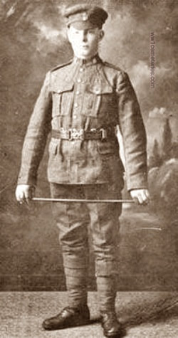
Picture © Werner Van Caneghem
Picture © Werner Van Caneghem
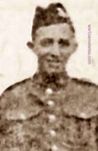
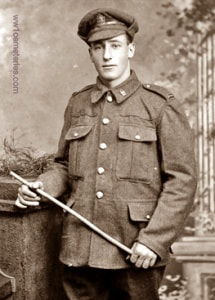
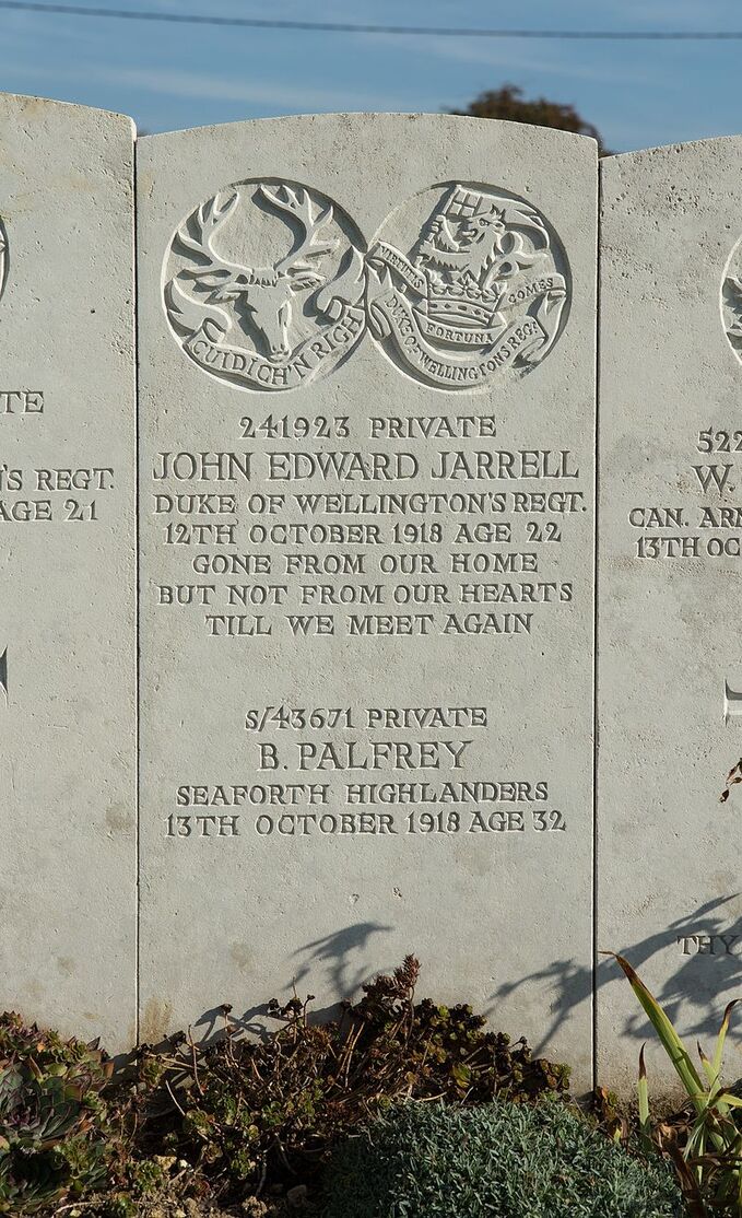
790101 Private
Alphonse Joseph Angelo
47th Bn. Canadian Infantry
28th September 1918.
Row C. 15.
Alphonse Joseph Angelo
47th Bn. Canadian Infantry
28th September 1918.
Row C. 15.
3180061 Private
Polide Aucoin
25th Bn. Canadian Infantry
9th October 1918, aged 21.
Row D. 21.
Son of Paul and Helen Aucoin, of Cheticamp, Inverness Co., Nova Scotia.
Polide Aucoin
25th Bn. Canadian Infantry
9th October 1918, aged 21.
Row D. 21.
Son of Paul and Helen Aucoin, of Cheticamp, Inverness Co., Nova Scotia.
48678 Private
John T. Bannister
2nd/7th Bn. The King's (Liverpool Regiment)
27th September 1918.
Row C. 2.
John T. Bannister
2nd/7th Bn. The King's (Liverpool Regiment)
27th September 1918.
Row C. 2.
461398 Private
Lionel Douglas Bowen
1st Bn. Canadian Machine Gun Corps
1st October 1918, aged 23.
Row C. 42.
Son of Henry C. and Katie J. Bowen, of Orono, Ontario.
Lionel Douglas Bowen
1st Bn. Canadian Machine Gun Corps
1st October 1918, aged 23.
Row C. 42.
Son of Henry C. and Katie J. Bowen, of Orono, Ontario.
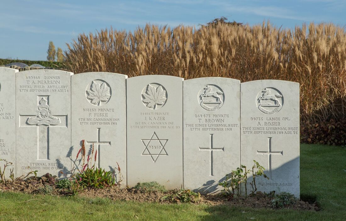
269473 Private
Thomas Brown
2nd/7th Bn. The King's (Liverpool Regiment)
27th September 1918.
Row B. 72.
Thomas Brown
2nd/7th Bn. The King's (Liverpool Regiment)
27th September 1918.
Row B. 72.
706030 Lance Corporal
Bernard Walter Hugh Doughty
"G" Coy. 47th Bn. Canadian Infantry
27th September 1918, aged 22.
Row B. 37.
Son of James and Emily Doughty, of Victoria, British Columbia.
His headstone bears the inscription; "Parted For Just A little While."
Bernard Walter Hugh Doughty
"G" Coy. 47th Bn. Canadian Infantry
27th September 1918, aged 22.
Row B. 37.
Son of James and Emily Doughty, of Victoria, British Columbia.
His headstone bears the inscription; "Parted For Just A little While."
342320 Gunner
Milford Morrison Ford
5th Bde. Canadian Field Artillery
29th September 1918, aged 29.
Row C. 29.
Son of Ezra A. and Ellen Ford, of 58, Gordon St., Guelph, Ontario.
Milford Morrison Ford
5th Bde. Canadian Field Artillery
29th September 1918, aged 29.
Row C. 29.
Son of Ezra A. and Ellen Ford, of 58, Gordon St., Guelph, Ontario.
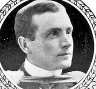
Lieutenant
Leslie Willoughby Franklin
10th Bty. 147th Bde. Royal Field Artillery
16th October 1918, aged 20.
Row E. 15.
Son of J. W. and S. A. Franklin, of "Minato," 5, Dene Rd., Northwood, Middx. Born at Kobe, Japan.
His headstone bears the inscription; "So Young, So Dear He Left Us But The Flowers Of Memory."
678042 Private
Guy Wray Garrett
1st Canadian Mounted Rifles Battalion
9th October 1918.
Row D. 22.
Guy Wray Garrett
1st Canadian Mounted Rifles Battalion
9th October 1918.
Row D. 22.
3130454 Private
George Gray
47th Bn. Canadian Infantry
27th September 1918, aged 25.
Row B. 34.
Son of Alexander and Mary Gray, of Newbury, Middlesex Co., Ontario.
George Gray
47th Bn. Canadian Infantry
27th September 1918, aged 25.
Row B. 34.
Son of Alexander and Mary Gray, of Newbury, Middlesex Co., Ontario.
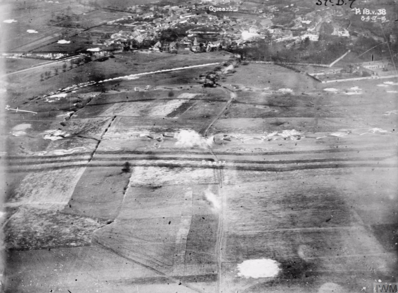
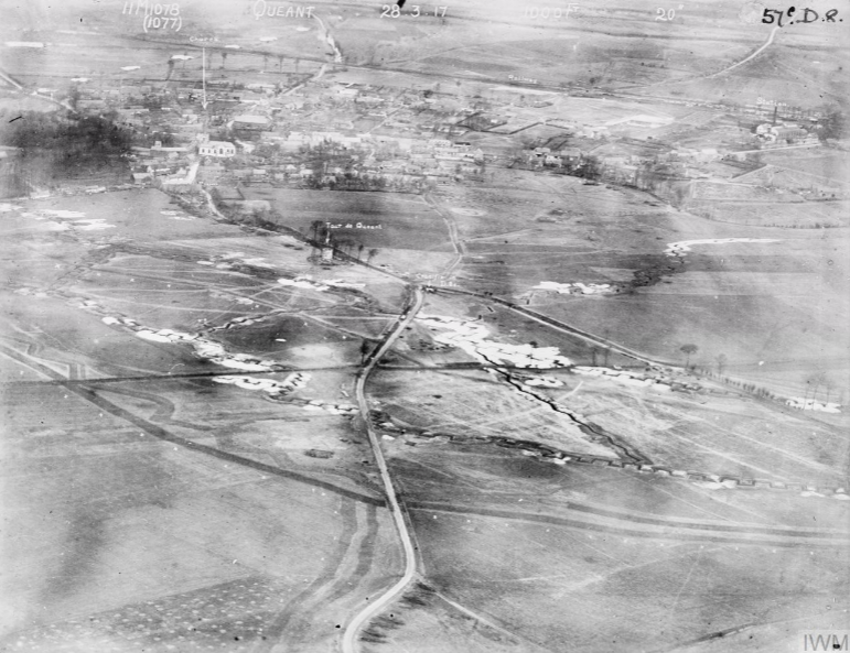
Aerial Photo, Queant, 57c. D. 7. © IWM (Q 49749)
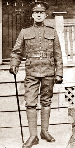
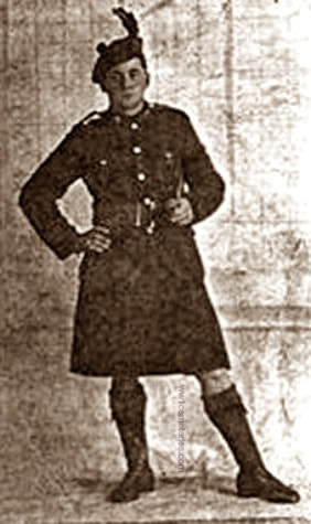
2/1172 Farrier Serjeant
Reginald John Hancock, M. S. M.
New Zealand Field Artillery
22nd September 1918, aged 33.
Row B. 11.
Husband of Florence Jane Hancock, of Bombay, Auckland, New Zealand.
Reginald John Hancock, M. S. M.
New Zealand Field Artillery
22nd September 1918, aged 33.
Row B. 11.
Husband of Florence Jane Hancock, of Bombay, Auckland, New Zealand.
314193 Driver
Frank Major Hughes
9th Bde. Canadian Field Artillery
28th September 1918, aged 23.
Row C. 17.
Son of George E. and Anna Gordon Hughes, of Charlottetown, Prince Edward Island. Enlisted March, 1915.
His headstone bears the inscription; "Died For Honor And Freedom"
Frank Major Hughes
9th Bde. Canadian Field Artillery
28th September 1918, aged 23.
Row C. 17.
Son of George E. and Anna Gordon Hughes, of Charlottetown, Prince Edward Island. Enlisted March, 1915.
His headstone bears the inscription; "Died For Honor And Freedom"
2476302 Private
Nelson Jarvis
11th Field Amb. Canadian Army Medical Corps
29th September 1918.
Row C. 45.
Nelson Jarvis
11th Field Amb. Canadian Army Medical Corps
29th September 1918.
Row C. 45.
643375 Private
Robert Andrew Addison Leece
1st Bn. Canadian Infantry
28th September 1918.
Row C. 9.
Robert Andrew Addison Leece
1st Bn. Canadian Infantry
28th September 1918.
Row C. 9.
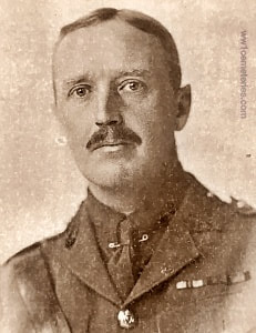
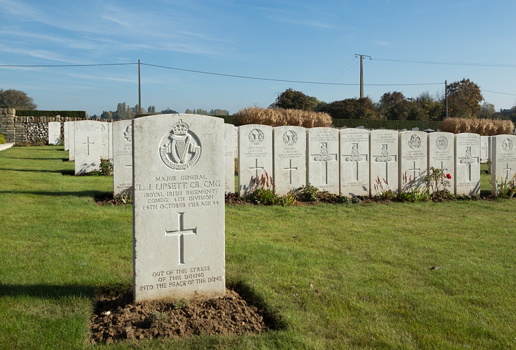
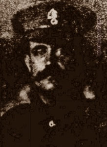
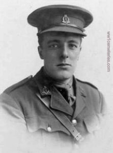
Major General
Louis James Lipsett, C B, C M G, Twice Mentioned in Despatches
Cdg. 4th (British) Div. (formerly Commanded 3rd Canadian Div.)
General Staff. LATE Royal Irish Regiment.
14th October 1918, aged 44.
Row F. 1.
Son of Richard and Esther Lipsett, of Ballyshannon, Co. Donegal.Awarded the Croix de Guerre (France), Officier de la Legion d'Honneur.
His headstone bears the inscription; "Out Of The Stress Of The Doing Into The Peace Of The Done."
Aerial photograph of Queant, near Arras. Sheet 57c, D8. Date 28 March 1917. © IWM (Q 58442)
651904 Private
William Wallace McKay
47th Bn. Canadian Infantry
27th September 1918, aged 37.
Row B. 67.
Only son of Benjamin and Christiana Yeats McKay, of Walkerton, Ontario.
His headstone bears the inscription; "God Is Love."
William Wallace McKay
47th Bn. Canadian Infantry
27th September 1918, aged 37.
Row B. 67.
Only son of Benjamin and Christiana Yeats McKay, of Walkerton, Ontario.
His headstone bears the inscription; "God Is Love."
1251570 Gunner
Thomas Arthur Moffat
10th Bde. Canadian Field Artillery
29th September 1918, aged 22.
Row C. 27.
Son of Mr. and Mrs. John G. Moffat, of 256, Addington Avenue, Montreal.
Thomas Arthur Moffat
10th Bde. Canadian Field Artillery
29th September 1918, aged 22.
Row C. 27.
Son of Mr. and Mrs. John G. Moffat, of 256, Addington Avenue, Montreal.
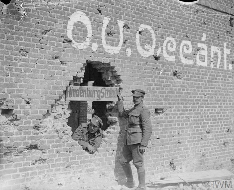
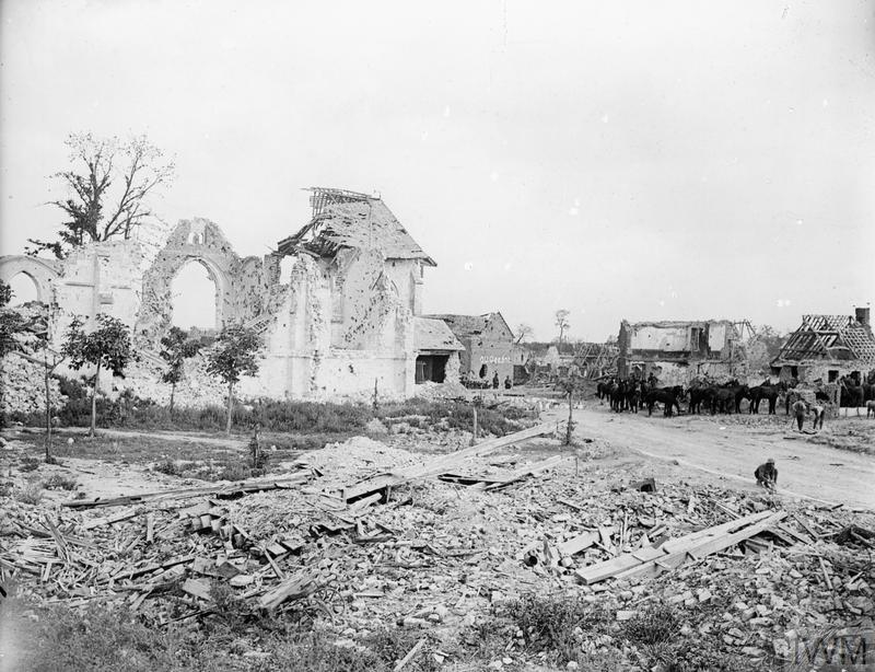
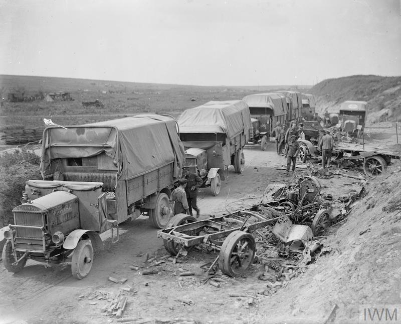
German signs (O.U.-Orts-Unterkunft-Billets and Hindenburg Schlucht - Hindenburg Ravine) in Queant, 6 September 1918. © IWM (Q 7057)
86972 Driver
Harold Parks
4th Bde. Canadian Field Artillery
29th September 1918.
Row B. 63.
Harold Parks
4th Bde. Canadian Field Artillery
29th September 1918.
Row B. 63.
425222 Sergeant
Harry James Proven
1st Canadian Mounted Rifles Battalion
29th September 1918, aged 25.
Row C. 24.
Son of James and Harriett Proven, of Clanwilliam, Manitoba.
His headstone bears the inscription; "Son Of James & Harriett Proven Clanwilliam, Manitoba Served 3 Years & 8 Months."
Harry James Proven
1st Canadian Mounted Rifles Battalion
29th September 1918, aged 25.
Row C. 24.
Son of James and Harriett Proven, of Clanwilliam, Manitoba.
His headstone bears the inscription; "Son Of James & Harriett Proven Clanwilliam, Manitoba Served 3 Years & 8 Months."
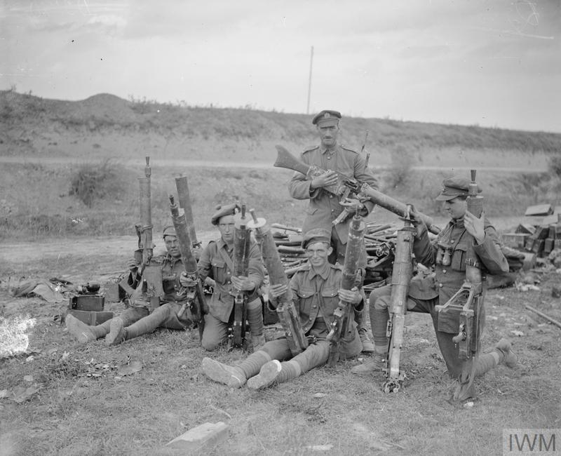
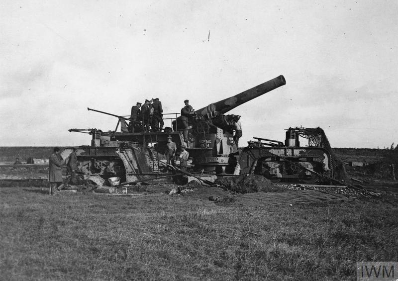
Troops of the 52nd (Lowland) Division with captured German MG 08/15 machine guns. Queant, 6 September 1918. © IWM (Q 7055)
171720 Sergeant
Meirion Roberts
3rd Bn. Canadian Infantry
27th September 1918.
Row C. 20.
Meirion Roberts
3rd Bn. Canadian Infantry
27th September 1918.
Row C. 20.
20813 Lance Corporal
Norman James Robison
"D" Coy. 10th Bn. Canadian Infantry
29th September 1918, aged 25.
Row B. 61.
Son of George and Margaret Robison, of South Lethbridge, Alberta.
Norman James Robison
"D" Coy. 10th Bn. Canadian Infantry
29th September 1918, aged 25.
Row B. 61.
Son of George and Margaret Robison, of South Lethbridge, Alberta.
99735 Lance Corporal
Alfred Roser
2nd/7th Bn. The King's (Liverpool Regiment)
27th September 1918, aged 35.
Row B. 73.
Son of George and Ellen Roser, of Ockley, Surrey; husband of Emma Jane Snape (formerly Roser), of 7, Coventry Rd., South Norwood, London.
His headstone bears the inscription; "Till We Meet Again."
Alfred Roser
2nd/7th Bn. The King's (Liverpool Regiment)
27th September 1918, aged 35.
Row B. 73.
Son of George and Ellen Roser, of Ockley, Surrey; husband of Emma Jane Snape (formerly Roser), of 7, Coventry Rd., South Norwood, London.
His headstone bears the inscription; "Till We Meet Again."
Captain
Andrew Ross
12th Field Amb. Canadian Army Medical Corps
29th September 1918, aged 42.
Row C. 35.
Son of Kenneth and Flora Ross, of 778, Palmerston Avenue, Toronto. Native of Ripley, Ontario.
His headstone bears the inscription; "For To Me, To Live Is Christ, And To Die Is Gain." (Biblical - Philippians 1:21)
Captain
Kenneth Ross
Royal Army Medical Corps, attd. 1st/5th Bn. Highland Light Infantry
17th September 1918.
Row A. 42.
Kenneth Ross
Royal Army Medical Corps, attd. 1st/5th Bn. Highland Light Infantry
17th September 1918.
Row A. 42.
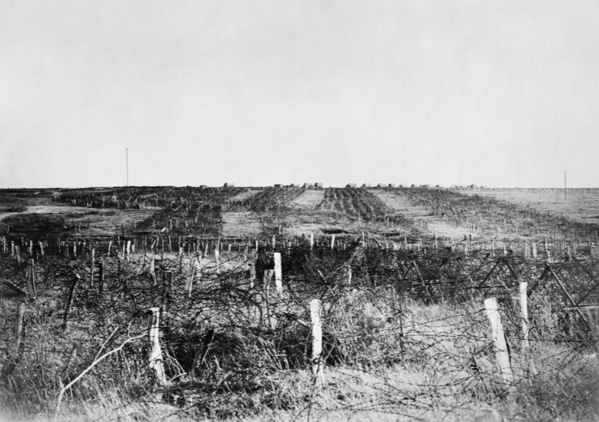
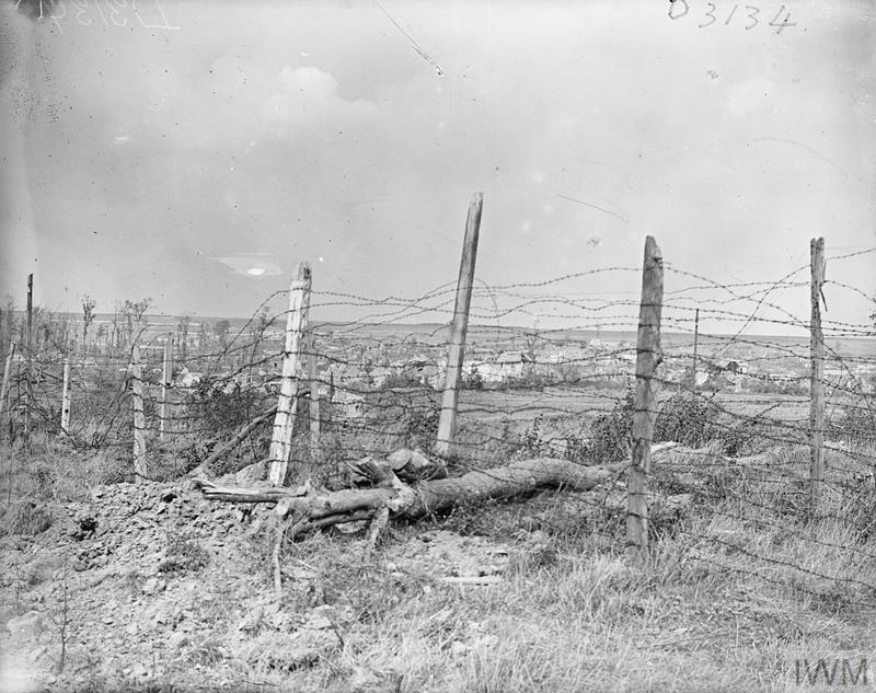
Battle Scenes: German barbed wire defences at Queant in the Hindenburg Line. © IWM (CO 3392)
901199 Corporal
Alonzo Weatherbe
25th Bn. Canadian Infantry
20th September 1918.
Row B. 5.
Alonzo Weatherbe
25th Bn. Canadian Infantry
20th September 1918.
Row B. 5.
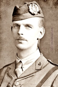
Captain
William Scott Branks Wilson
6th Bn. Cameronians (Scottish Rifles)
19th September 1918, aged 39.
Row A. 57.
Husband of Agnes C. Wilson, of The Grange, Lanark.
His headstone bears the inscription; "With Christ."
William Scott Branks Wilson
6th Bn. Cameronians (Scottish Rifles)
19th September 1918, aged 39.
Row A. 57.
Husband of Agnes C. Wilson, of The Grange, Lanark.
His headstone bears the inscription; "With Christ."
3231477 Private
Isaiah Woolman
20th Bn. Canadian Infantry
11th October 1918, aged 26.
Row D. 51.
Son of Isaiah and Emma Woolman, of Otter Lake Station, Ontario.
His headstone bears the inscription; "Safe In The Arms Of Jesus."
Isaiah Woolman
20th Bn. Canadian Infantry
11th October 1918, aged 26.
Row D. 51.
Son of Isaiah and Emma Woolman, of Otter Lake Station, Ontario.
His headstone bears the inscription; "Safe In The Arms Of Jesus."
657935 Private
Edwin Lee Yeates
1st Bn. Canadian Infantry
27th September 1918, aged 37.
Row B. 25.
Edwin Lee Yeates
1st Bn. Canadian Infantry
27th September 1918, aged 37.
Row B. 25.
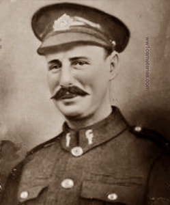
Picture © Werner Van Caneghem


