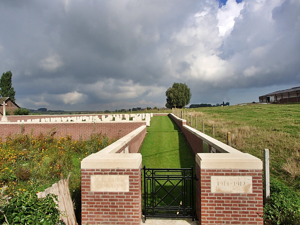
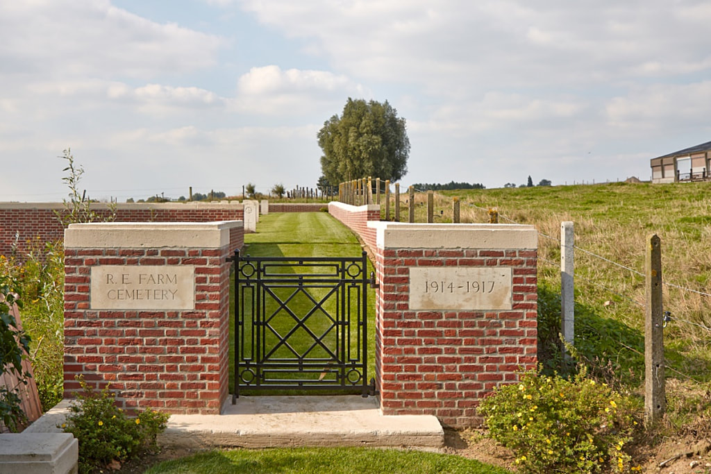
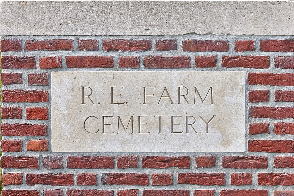
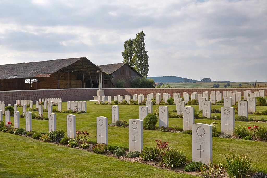
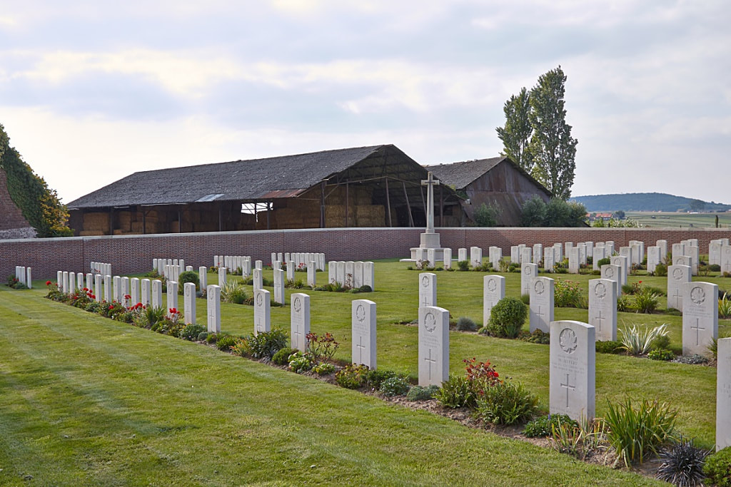
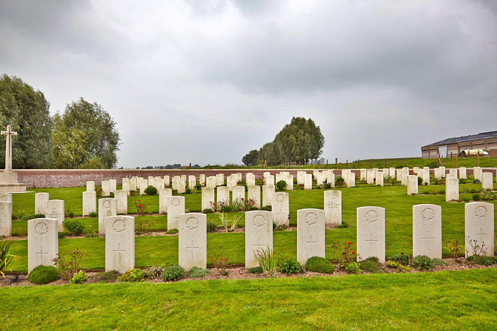
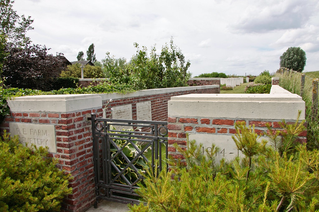
R. E. FARM CEMETERY
West-Vlaanderen
Belgium
GPS Coordinates - Latitude: 50.76696, Longitude: 2.86069
Location Information
R. E. Farm Cemetery is located 9.5 Kms south of Ieper town centre, on a road leading from the Rijselseweg N365, which connects Ieper to Wijtschate, Mesen and on to Armentieres.
From Ieper town centre the Rijselsestraat runs from the market square, through the Lille Gate (Rijselpoort) and directly over the crossroads with the Ieper ring road. The road name then changes to the Rijselseweg, (N365).
On reaching the village of Mesen the first right hand turning leads onto Mesenstraat, towards Wulvergem. On reaching the village of Wulvergem the first right hand turning at the church leads onto Wulvergemstraat. 500 metres along this road lies the junction with Vrooilandstraat. The cemetery itself lies 500 metres beyond this junction on the left hand side of the Wulvergemstraat.
Visiting Information
Wheelchair access to this cemetery is possible via main entrance.
Historical Information
Wytschaete (now Wijtschate) was in Allied hands until 1 November 1914, from June 1917 to April 1918, and from 28 September 1918 onwards. It was the scene of exceptionally severe fighting in November 1914 and April 1918.
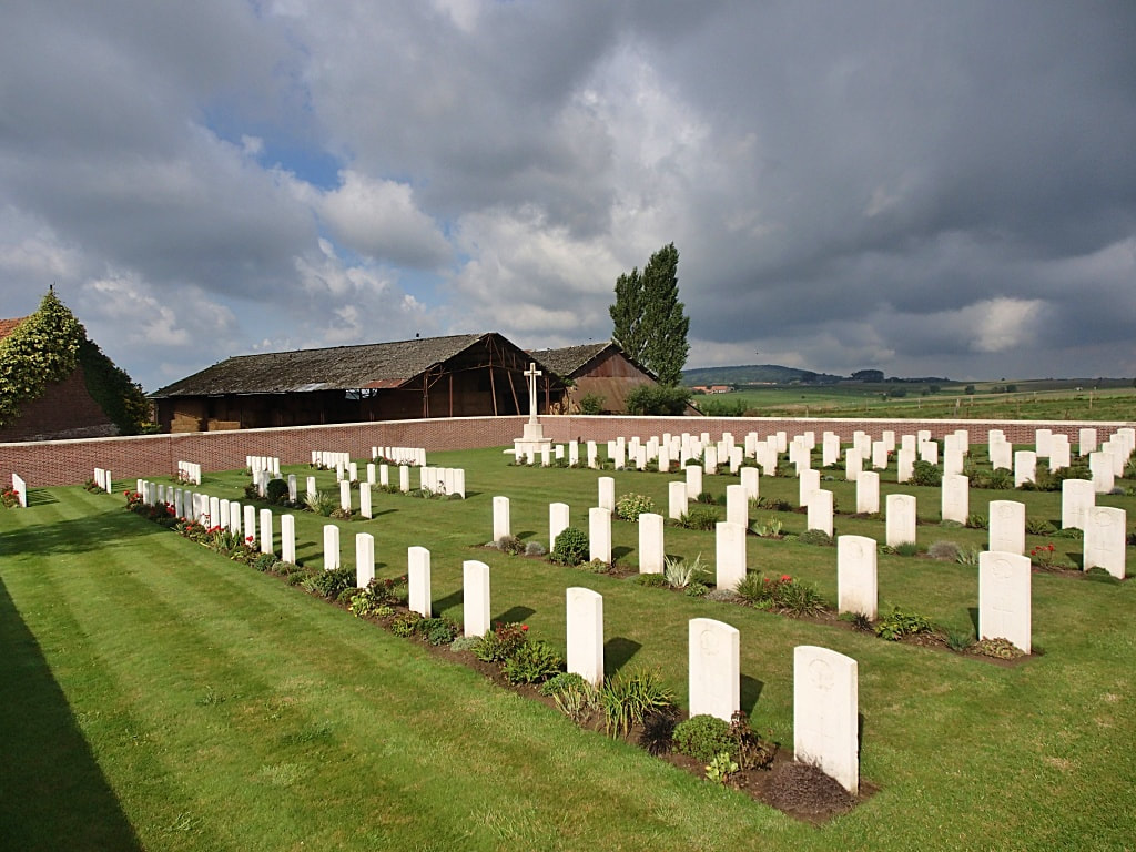
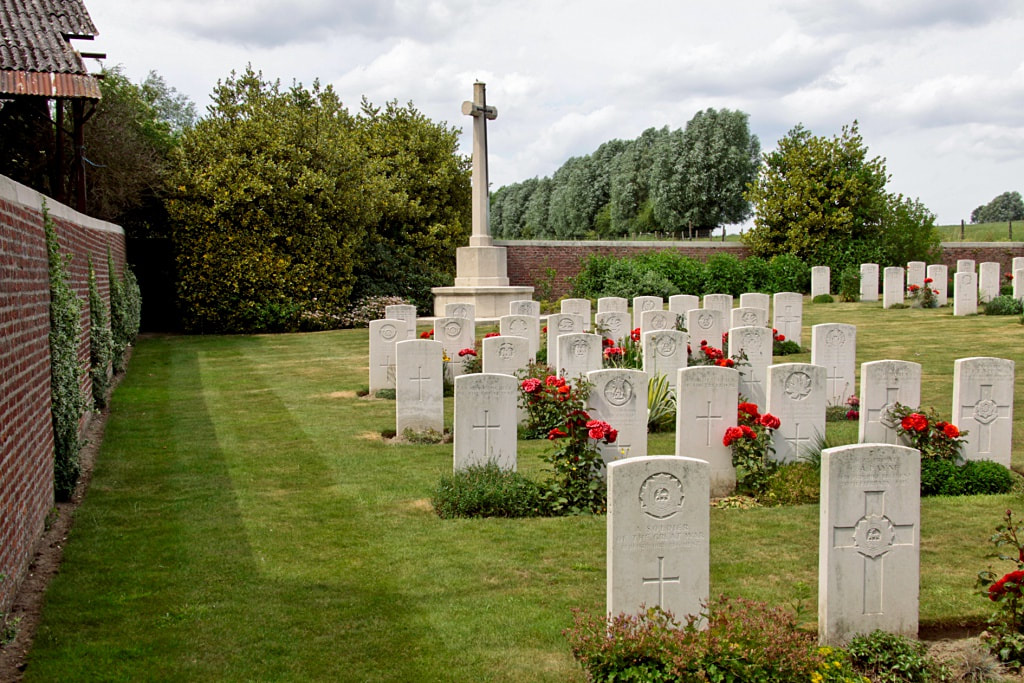
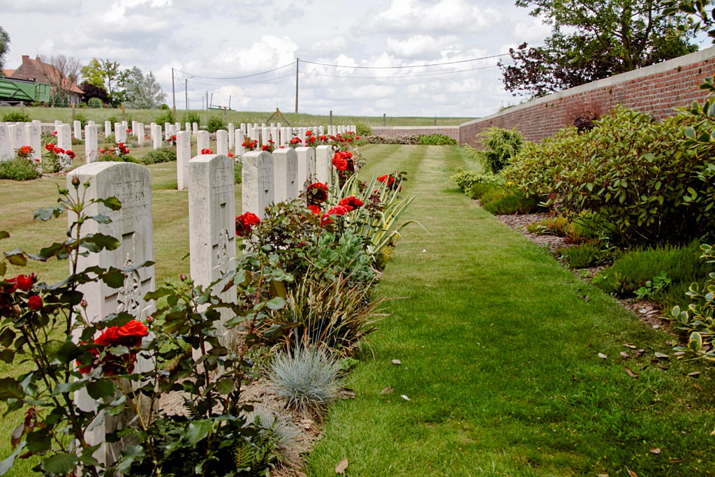
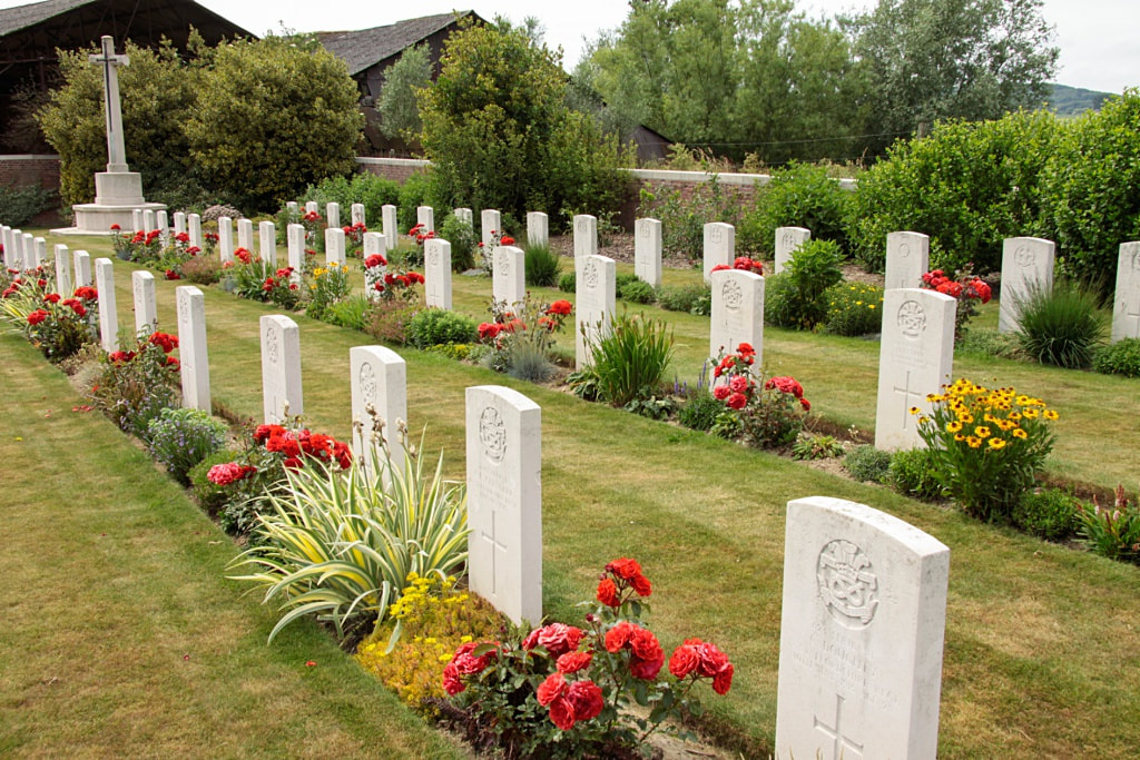
"R.E. Farm" was the military name given to the Ferme des douze Bonniers. This building remained in Allied hands until April 1918. In December 1914 the 1st Dorsets began a cemetery (No.1) on the east side of the farm, which was used by fighting units and field ambulances until April 1916, and occasionally in 1917. In January 1915, the same battalion began another cemetery (No.2) on the west side of the farm. This cemetery was little used and after the Armistice, the 23 graves it contained were moved into No.1, which was then renamed. R.E. Farm Cemetery contains 179 First World War burials, 11 of them unidentified.
Total Burials: 179.
Identified Casualties: United Kingdom 121, Canada 47. Total 168.
Unidentified Casualties: 11.
The cemetery was designed by W C Von Berg.
R. E. Farm Cemetery is located 9.5 Kms south of Ieper town centre, on a road leading from the Rijselseweg N365, which connects Ieper to Wijtschate, Mesen and on to Armentieres.
From Ieper town centre the Rijselsestraat runs from the market square, through the Lille Gate (Rijselpoort) and directly over the crossroads with the Ieper ring road. The road name then changes to the Rijselseweg, (N365).
On reaching the village of Mesen the first right hand turning leads onto Mesenstraat, towards Wulvergem. On reaching the village of Wulvergem the first right hand turning at the church leads onto Wulvergemstraat. 500 metres along this road lies the junction with Vrooilandstraat. The cemetery itself lies 500 metres beyond this junction on the left hand side of the Wulvergemstraat.
Visiting Information
Wheelchair access to this cemetery is possible via main entrance.
Historical Information
Wytschaete (now Wijtschate) was in Allied hands until 1 November 1914, from June 1917 to April 1918, and from 28 September 1918 onwards. It was the scene of exceptionally severe fighting in November 1914 and April 1918.
"R.E. Farm" was the military name given to the Ferme des douze Bonniers. This building remained in Allied hands until April 1918. In December 1914 the 1st Dorsets began a cemetery (No.1) on the east side of the farm, which was used by fighting units and field ambulances until April 1916, and occasionally in 1917. In January 1915, the same battalion began another cemetery (No.2) on the west side of the farm. This cemetery was little used and after the Armistice, the 23 graves it contained were moved into No.1, which was then renamed. R.E. Farm Cemetery contains 179 First World War burials, 11 of them unidentified.
Total Burials: 179.
Identified Casualties: United Kingdom 121, Canada 47. Total 168.
Unidentified Casualties: 11.
The cemetery was designed by W C Von Berg.
Cemetery images in this gallery © Geerhard Joos

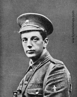
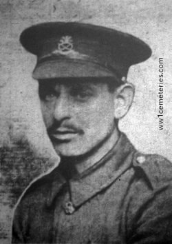
25128 Private
Joseph Albin
7th Bn. East Lancashire Regiment
20th June 1917, aged 26.
Plot III. B. 1.
Husband of Lizzie Albin, of 4, Brookfield St., Blackburn.
His headstone bears the inscription "He's Fought The fight The Victory Won We Weep But Say God's Will Be Done"
Joseph Albin
7th Bn. East Lancashire Regiment
20th June 1917, aged 26.
Plot III. B. 1.
Husband of Lizzie Albin, of 4, Brookfield St., Blackburn.
His headstone bears the inscription "He's Fought The fight The Victory Won We Weep But Say God's Will Be Done"
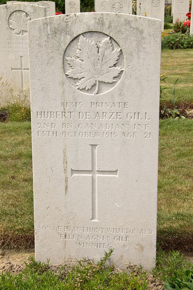
A/10472 Private
George Victor Coker
2nd Bn. Canadian Infantry
23rd February 1916.
Plot III. B. 13.
George Victor Coker
2nd Bn. Canadian Infantry
23rd February 1916.
Plot III. B. 13.
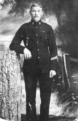
9101 Private
William Drakeford
1st Bn. North Staffordshire Regiment
4th April 1916, aged 40.
Plot III. A. 3.
Husband of Elizabeth Ann Drakeford, of 10, Ayshford St., Longton, Staffs.
William Drakeford
1st Bn. North Staffordshire Regiment
4th April 1916, aged 40.
Plot III. A. 3.
Husband of Elizabeth Ann Drakeford, of 10, Ayshford St., Longton, Staffs.
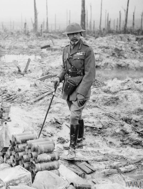
HM King George V, on Wytschaete Ridge in Belgium on 4 July 1917 during a tour of the Western Front. © IWM (Q 5586)
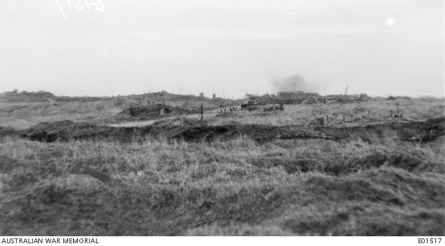
A British soldier looks out across the Douve Valley, as shells explode on the village of Messines, 8th June, 1917. © IWM Q 2295
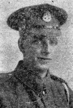
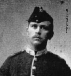
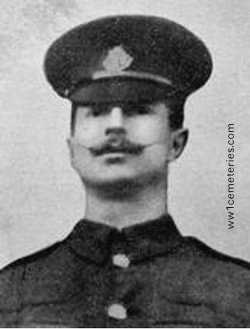
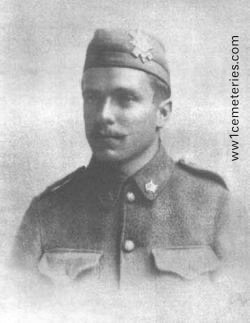
2679 Lance Corporal
Alan George Evans
"F" Company, 1st/5th Bn. North Staffordshire Regiment
1st June 1915, aged 20.
Plot IV. C. 5.
Son of Samuel P. and Ada L. Evans, of 6, Clive St., Shelton, Stoke-on-Trent.
His headstone bears the inscription "Until The Day Dawn"
Alan George Evans
"F" Company, 1st/5th Bn. North Staffordshire Regiment
1st June 1915, aged 20.
Plot IV. C. 5.
Son of Samuel P. and Ada L. Evans, of 6, Clive St., Shelton, Stoke-on-Trent.
His headstone bears the inscription "Until The Day Dawn"
2377 Private
Raymond Fisher
6th Bn. North Staffordshire Regiment
19th June 1915, aged 22.
Plot IV. A. 18.
Son of Samuel Joseph and Elizabeth Annie Fisher, of 9, Needwood St., Burton-on-Trent.
His headstone bears the inscription "His Duty Done he Sleeps Well"
Raymond Fisher
6th Bn. North Staffordshire Regiment
19th June 1915, aged 22.
Plot IV. A. 18.
Son of Samuel Joseph and Elizabeth Annie Fisher, of 9, Needwood St., Burton-on-Trent.
His headstone bears the inscription "His Duty Done he Sleeps Well"
7005 Private
Ernest Gallimore
1st Bn. North Staffordshire Regiment
4th April 1916.
Plot III. A. 2.
Ernest Gallimore
1st Bn. North Staffordshire Regiment
4th April 1916.
Plot III. A. 2.
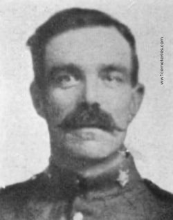
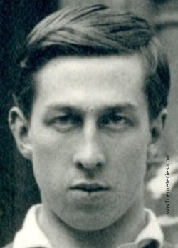
Lieutenant
Maurice William Hand
1st Bn. Cheshire Regiment
25th January 1915.
Plot I. A. 7.
Maurice William Hand
1st Bn. Cheshire Regiment
25th January 1915.
Plot I. A. 7.
Images in this gallery © Werner Van Caneghem
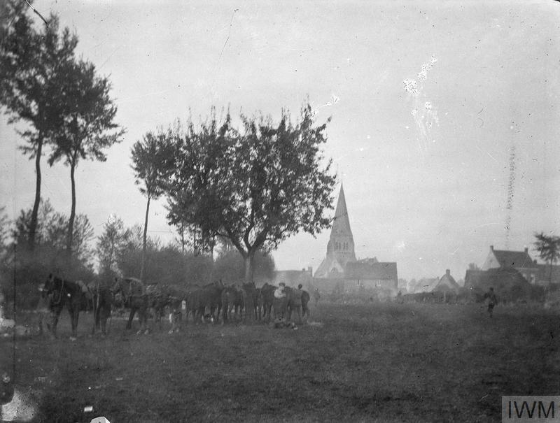
Soldiers of the 11th Regiment Hussars (Prince Albert's Own) at Wulverghem. Church in background. 23rd October 1914. © IWM (Q 51144)
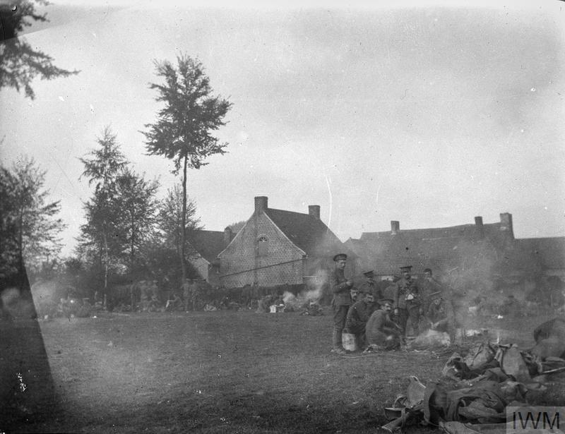
Bivouac of the 11th Regiment Hussars (Prince Albert's Own) at Wulverghem, 23rd October 1914. Units came back from the Messines line in turn to rest. © IWM (Q 51178)
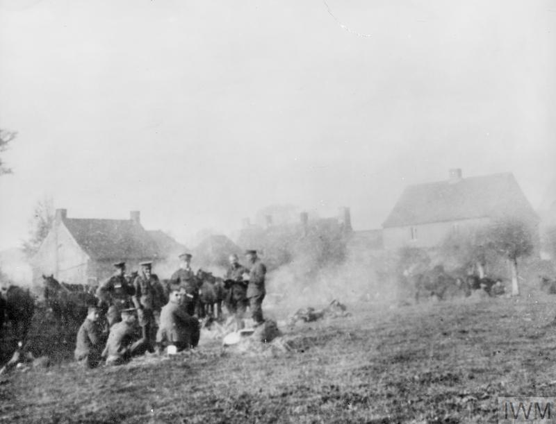
Bivouac of the 11th Regiment Hussars (Prince Albert's Own) at Wulverghem, 23rd October 1914. © IWM (Q 51169)
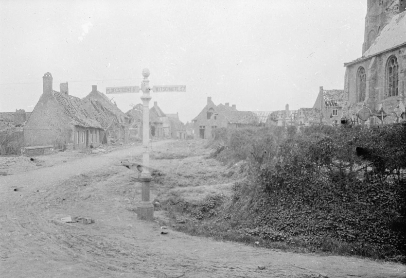
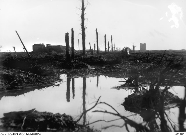
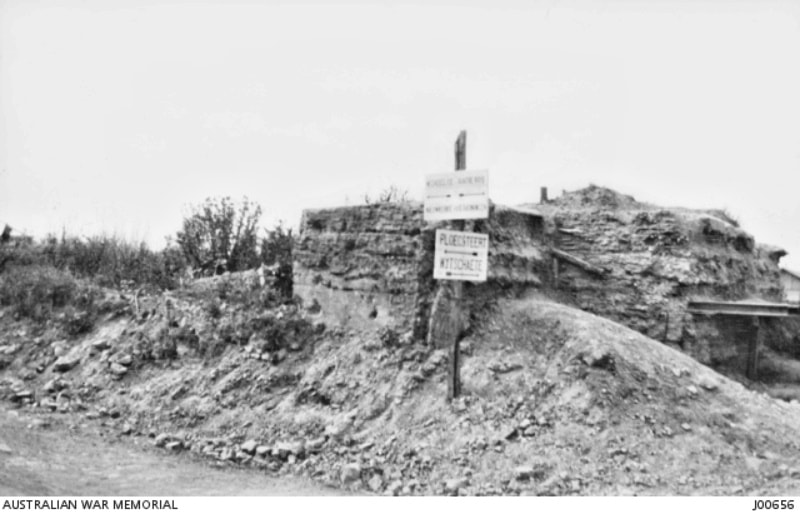
Ruined village of Wulverghem.
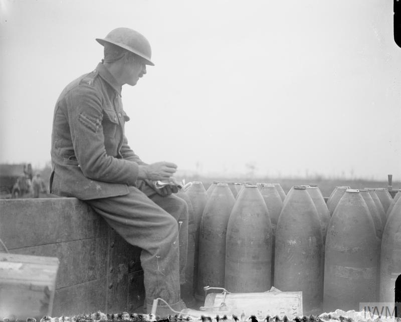
A Corporal checking shells arriving on a light railway. Wytschaete, 11 August 1917. © IWM (Q 5871)
8449 Private
James Harty
2nd Bn. Canadian Infantry
30th December 1915.
Plot III. C. 8.
James Harty
2nd Bn. Canadian Infantry
30th December 1915.
Plot III. C. 8.
A/10773 Private
Rexford Hurlbert
2nd Bn. Canadian Infantry
29th November 1915, aged 20.
Plot III. B. 12.
Son of W. B. and Elizabeth Hurlbert, of Smith's Falls, Ontario, Canada. Native of Scranton, Penn, U.S.A.
Rexford Hurlbert
2nd Bn. Canadian Infantry
29th November 1915, aged 20.
Plot III. B. 12.
Son of W. B. and Elizabeth Hurlbert, of Smith's Falls, Ontario, Canada. Native of Scranton, Penn, U.S.A.
2495 Private
Henry Patrick
6th Bn. North Staffordshire Regiment
19th June 1915.
Plot IV. A. 17.
Husband of C. Patrick, of 8, Stanley Rd., Stratford, London.
Henry Patrick
6th Bn. North Staffordshire Regiment
19th June 1915.
Plot IV. A. 17.
Husband of C. Patrick, of 8, Stanley Rd., Stratford, London.
419020 Private
George Robert Ward
42nd Bn. Canadian Infantry
12th January 1916.
Plot III. A. 11.
George Robert Ward
42nd Bn. Canadian Infantry
12th January 1916.
Plot III. A. 11.